A couple of weeks back, we set forth in our sparkly new FTL survey ship to explore the 15,000 star systems within 100 light years of Earth. We hopped around a particular system to track down any planets it might have, and now we’re going to take a closer look at them. While it would be fun to zap down to the surface to get hands-on information, our mission really is survey. Let’s find the interesting places and let some other poor schmuck get fitted for a red shirt.
So what can we do from orbit?
In a lot of ways, this is a question for the CIA, or more accurately the National Reconnaissance Office (NRO), the agency in charge of the various US spy satellites. Most of us think of spy satellites as peeking in on missile complexes or uranium enrichment plants, but at a lower resolution, they are quite useful for map-making.
And that gets right to the heart of the matter: resolution vs. coverage area. The optical sensor in your orbital platform is of some fixed size. Maybe it’s ten centimeters or a full meter, but the key is that it’s a fixed number of pixels across, perhaps a hundred thousand. If your optical lenses project an image that represents a square kilometer on the ground, your resolution would be one hundred thousandth of a kilometer, i.e. a centimeter.
While centimeter resolution might thrill the NRO, it’s wasted on us for survey purposes, and the Earth would require at least 500 million of those snapshots. If we had that large of a sensor, we would be much better off taking snapshots of 100km by 100km and getting 1 meter resolution.
You can play around with this a little by taking pictures of things not directly beneath you but scanning east to west and patching them together, but doing it quickly (that is, at orbital speeds) could get quite complicated. I don’t know if our current spy satellites can manage that kind of east-west scanning, or if they simply have to pick their targets more carefully.
In addition to visible-light photography, we can take photographs at varying resolutions in the infrared and ultraviolet. Add in a RADAR transmitter, and we can do terrain height mapping as we fly over.

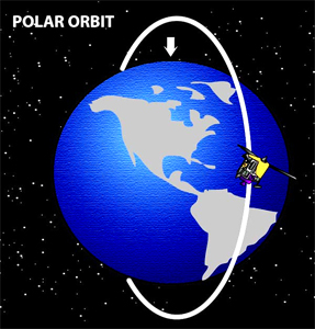
But how long does this take? Let’s assume a planet the size of the Earth. We do our observations from a polar orbit, taking 100km-wide swaths of photographs as we go. We’ll get lots of overlap near the poles, but we have to make enough passes to cover the entire equator in 100km chunks. At 40,000km around, that’s 400 passes. Orbit times depend on the mass of the planet and the height of the orbit, and on earth we see orbits range from 92 minutes (on the International Space Station) to 27 days (the moon).
But the Earth spins, and since that’s helpful, let’s hope our new planet does too. After 92 minutes, the equatorial land we pass over on the day-side is 2500km from the last picture we took. It would be nicer if it had only moved 100km, but we can work with that. If we choose our orbital altitude correctly, we can get our orbital period to line up so that we’re always hitting some multiple of 100km from the last pass, and with the right rhythm, we’ll keep hitting fresh bits of the equator. It’s one of those prime factor things, cycling over 400 swaths by 3’s (or 7’s, 11’s, 13’s, etc.) will keep hitting new swaths.
We may as well photograph things on the night side as well to capture any surprises like city lights, but we’ll mostly want the daylight side. So that’s 400 orbits of 90 minutes or more, which will take at least 25 days. It would take longer if we want higher resolution, or be done quicker if we settle for lower resolution. Notably, that centimeter resolution could take years, while backing off to 10m resolution could get the job done in a few days. Oh, and then there might be weather getting in your way.
See what I mean about the quandary of coverage vs. resolution? When flying over some of the overlapped areas away from the equator, you can squeeze in some zoomed shots of the more interesting bits, but your overall schedule is going to push your towards the lower resolution. With 15,000 star systems to get to, it’s going to be a hard argument to push for something greater than 10m resolution.
But what can we do to fit more into our schedule? I’ll be talking about that next week when I go after some of the logistics to make this survey project more feasible. Or maybe I’ll just see how mammoth it really is. Either way, I’m still wallowing in wish fulfillment, eager to don my Survey uniform.

As long as the number of cycles and the offset are *relatively* prime, having no factors in common besides 1, it’ll work. With 400 swaths, an offset of 21 will work, even though 21 itself is not prime. Much smaller example available upon request.
Indeed.
Leave it to my mathy bride to get it right. 🙂